Deep depression crossing the coast, risking tidal waves
Samakal Correspondent
29 May 2025 16:57 PM
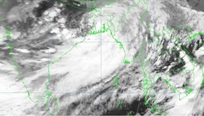
A deep depression in the Bay of Bengal has intensified and begun crossing the West Bengal-Bangladesh coast near Sagardwip and Khepupara, according to the Meteorological Department's latest special notification on Thursday.
It is expected to move further north, fully crossing the coast by evening and gradually weakening.
All seaports in the country are under warning signal number three due to the risk of gusty or squally winds, with maximum wind speeds of 50 kmph near the depression's center, rising to 60 kmph in gusts.
The sea remains rough in the affected area.
The coastal districts of Chittagong, Noakhali, Laxmipur, Feni, Chandpur, Bhola, Hatia, Sandwip, Barguna, Patuakhali, Barisal, Pirojpur, Jhalakathi, Bagerhat, Khulna, Satkhira, and nearby islands and chars face a risk of 2 to 4 feet storm surges due to the new moon and the deep depression.
Seaports at Chittagong, Cox’s Bazar, Mongla, and Payra have been instructed to display local warning signal number three.
All fishing boats and trawlers in the north Bay of Bengal are advised to remain in safe shelter until further notice.
The depression, which formed as a low pressure area on Tuesday, intensified into a clear low pressure area, then a depression by Thursday morning, and later a deep depression.
It was located 375 km west-southwest of Chittagong Seaport, 385 km west of Cox’s Bazar Seaport, 170 km southwest of Mongla Seaport, and 210 km southwest of Payra Seaport at noon on Thursday.
The Meteorological Department forecasts continued rain across the country on Thursday and Friday, with heavy to very heavy rainfall expected in Mymensingh, Dhaka, Khulna, Barishal, Chittagong, and Sylhet divisions.
This heavy rainfall raises the risk of landslides in the hilly areas of Chittagong, Rangamati, Khagrachari, Bandarban, and Cox’s Bazar.
The Flood Forecasting and Warning Center warns that river water levels in the northern, northeastern, and eastern regions may exceed danger levels due to the heavy rainfall.
Rainfall is expected to decrease significantly from Saturday, particularly in Rajshahi and Rangpur divisions.
Temporary gusty or squally winds of 60 to 80 kmph from the west or northwest may affect Dhaka, Faridpur, Madaripur, Khulna, Barishal, Patuakhali, Noakhali, Comilla, and Chittagong, with a storm risk in six regions by 1 pm.
River ports in these areas are displaying naval warning signal number two. Over the next 120 hours from 9 am Thursday, light to moderate rain or thundershowers with gusty winds and lightning are forecast for most of Rangpur, Rajshahi, Mymensingh, Dhaka, Khulna, Barisal, Chittagong, and Sylhet divisions, with moderate to very heavy rain in some areas.
Daytime temperatures may drop by 1 to 2 degrees Celsius, with a slight decrease in nighttime temperatures.
Due to adverse weather, all launch movements on inland waterways from Barishal river port and on the Daulatdia-Paturia route have been suspended until further notice, as announced by the Bangladesh Inland Water Transport Authority (BIWTA) on Thursday morning.
Barishal River Port Officer Mohammad Selim Reza reported no launches have departed since morning due to gusty winds, rain, and turbulent river conditions, with the port displaying warning signal number two.
Launch operations will resume once conditions improve, though ferry operations remain normal.

